Magazine
January-February 2020
January-February 2020
Volume: 108 Number: 1
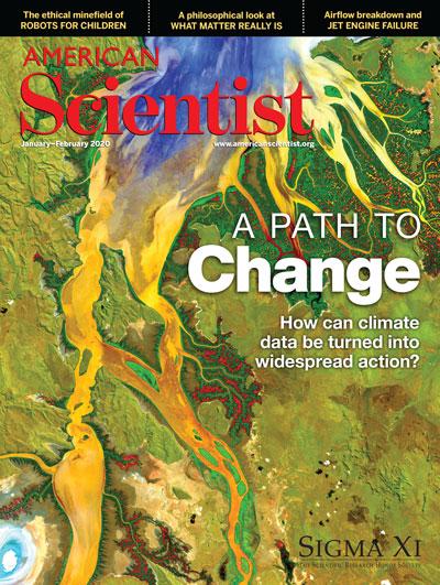
Remote sensing satellites make it possible to study the Earth in new ways, such as by documenting changes to the planet over time, including changes in climate. These space-based pictures have led to scientific discoveries, but the U.S. Geological Survey, which runs the Landsat program, also produces images for educational and reference purposes. Here, scientists enhanced a portion of a Landsat 8 image to show the patterns of tropical vegetation, sediment, and nutrients at an estuary in northwestern Australia. This kind of top-down dissemination of knowledge can be traced to remote sensing’s military origins in technologies designed to provide decision-makers with information on enemy whereabouts. In “How Climate Science Could Lead to Action,” (pages 34–41), Samantha Jo Fried describes this history and explains how rethinking the relationship to remote-sensing satellites could prompt more public engagement in addressing climate change. (Cover image produced by Geoscience Australia, a Landsat Science Team Member; courtesy of U.S. Geological Survey.)
In This Issue
- Agriculture
- Art
- Astronomy
- Biology
- Chemistry
- Communications
- Computer
- Engineering
- Environment
- Ethics
- Evolution
- Medicine
- Physics
- Policy
- Psychology
- Technology
What's Everything Made Of?
Charles T. Sebens
Physics
To answer the question of whether the fundamental building blocks of reality are particles, fields, or both, we must think beyond physics.
Why Brewers Choose Barley
Rob Desalle, Ian Tattersall
Agriculture Biology Evolution
The ancient grass’s enzymatic toolbox makes it ideal for beer making.