
This Article From Issue
March-April 2013
Volume 101, Number 2
Page 86
DOI: 10.1511/2013.101.86
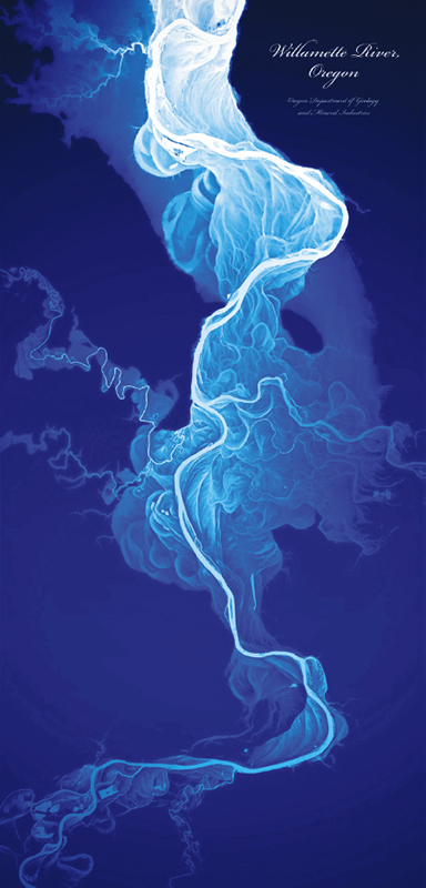
From Atlas of Design.
To the Editors:
In Tim Stallmann’s review of Atlas of Design (January–February), he discusses the continuing need for cartographers. The review includes a beautiful map of the Willamette River, created using LIDAR satellite data.
Satellites can be useful, but cartographers skilled in the pre-satellite era mapmaking practice are still needed. Caves are a case in point: Satellites and GPS devices are useless underground. Our son Brent and his wife, Nancy, are ardent cavers. Nancy was featured in the IMAX film Journey into Amazing Caves . Brent has explored and mapped numerous caves, mostly for the Speleological Society. They find that old-fashioned cartographic methods remain useful for mapping caves.
I concur with Stallmann that we should not close the door on cartographers yet.
Donald B. Aulenbach
Clifton Park, NY

American Scientist Comments and Discussion
To discuss our articles or comment on them, please share them and tag American Scientist on social media platforms. Here are links to our profiles on Twitter, Facebook, and LinkedIn.
If we re-share your post, we will moderate comments/discussion following our comments policy.