
This Article From Issue
March-April 2010
Volume 98, Number 2
Page 168
DOI: 10.1511/2010.83.168
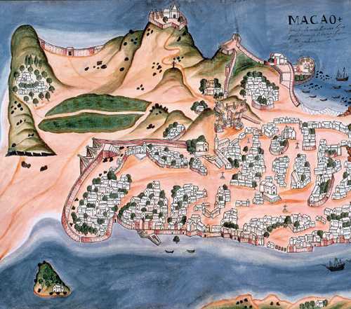
Modern practice in cartography favors the plan view—the landscape seen as if from an infinite height—but earlier mapmakers were more flexible about perspective. In this map of the Portuguese colony of Macao, drawn in 1646 by Pedro Barreto de Resende, an oblique view conveys information about both the horizontal layout of the town and the vertical scale of the terrain. This technique of land portraiture was known at the time as chorography.
From Mapping the World: Stories of Geography.
Ad Right
The view of Macao is one of about 90 maps reproduced in Mapping the World: Stories of Geography, by Caroline and Martine Laffon (Firefly Books, $39.95).
The Laffons emphasize that maps bring us more than the geographic coordinates of a place; they tell us stories about the landscape. For example, in the Barreto map of Macao, the most conspicuous features are fortifications, churches and houses built by the Portuguese. “As for the local population,” the Laffons write, “as on many colonial maps, they seem to be overshadowed by the new ruling class.”—Brian Hayes
American Scientist Comments and Discussion
To discuss our articles or comment on them, please share them and tag American Scientist on social media platforms. Here are links to our profiles on Twitter, Facebook, and LinkedIn.
If we re-share your post, we will moderate comments/discussion following our comments policy.